Leave a Message

Thank you for your message. We will be in touch with you shortly.

Tidal Access vs. Deep Water in Virginia Beach

November 21, 2025

Shopping for waterfront in Virginia Beach and wondering if “tidal access” will work for your boating, or if you need “deep water”? When you own a boat, the difference affects when you can leave the dock, what size vessel you can keep, and long‑term resale. In this guide, you will learn the plain‑language difference, how tides, depths, and bridges shape access, how to decode listing language, and what to check from Ashville Park and Lago Mar to Great Neck. Let’s dive in.

Tidal vs. deep water basics

Tidal access means your ability to get in and out depends on the tide cycle. You may have enough depth at high or mid tide but run out of water at low tide. That can work well for shallow‑draft boats if you plan your trips around tide windows.

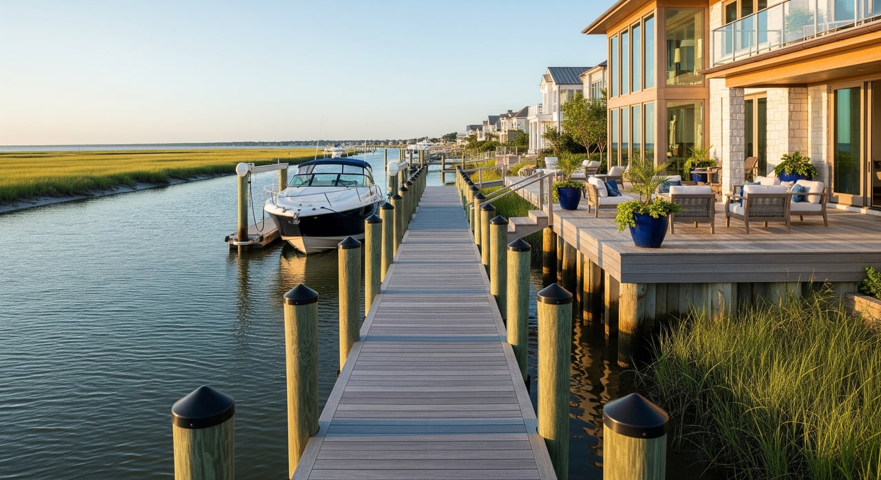
Deep‑water access means there is year‑round depth, referenced to the tidal datum used on nautical charts, that safely supports larger recreational vessels and often commercial craft. These channels are naturally deep or maintained by dredging.

There is no universal number that defines “deep water.” For a small powerboat, 6 to 8 feet may be adequate. Larger yachts may need 10 to 15 feet or more. Always match any listing claim to your vessel’s draft, plus a safety margin, and confirm the route’s shallowest controlling depth.

What really controls access

Tides and tidal range

Tides change your usable depth hour by hour. A property that looks great at high tide can be too shallow at low tide. Check a nearby tide station and plan transit times around the expected tide height. In narrow channels, tidal current also affects maneuvering and safety.

Charted vs. real‑time depth

Charted depths are snapshots tied to a tidal datum, often Mean Lower Low Water. Shoaling can make real‑time depths less than the chart shows. Recent maintenance dredging by the U.S. Army Corps of Engineers or the city is a strong indicator of reliable depth. For confidence when you buy, the most reliable proof is a recent sounding or a professional hydrographic survey.

Bridges and vertical clearance

Fixed bridges can limit your air draft even when the water is deep. Vertical clearance is measured from the waterline to the underside of the bridge and changes with the tide. Compare your vessel’s air draft to the listed clearance at the relevant tide height. If there is an opening bridge on your route, confirm its schedule and whether it opens for recreational boats.

Inlets and route to ocean

Short routes to an inlet with no fixed bridges make ocean access simpler. Properties on main rivers or the Intracoastal Waterway often have more reliable depth than homes on small creeks or lagoons. Closer to an inlet, expect deeper water but also stronger currents, shoaling, and more exposure to waves.

Docks, permits, and maintenance

Dock and bulkhead condition, permitted pier length, and whether your canal is maintained all shape real access. Many coastal neighborhoods rely on periodic municipal or HOA dredging. Private dock owners may be responsible for maintaining their own slips. Confirm Virginia Marine Resources Commission permits for existing or planned structures.

Storms and seasonal change

Storms can shift shoals quickly and change controlling depths. Over years, sea‑level rise and shoreline change alter how often channels need dredging and how “deep water” performs. Plan for periodic verification rather than a one‑time check.

Decode listing language

Common phrases to verify

  • “Deep water” or “true deep water”
    • Verify the charted depth at the dock and the shallowest controlling point to open water, and who maintains the channel.
  • “Tidal” or “tide‑dependent”
    • Verify the usable tide window and whether returning at a different tide could be a problem.
  • “Ocean access” or “no fixed bridges”
    • Verify route distance and time to the inlet, actual bridge clearances, and whether any bridge opens for recreational boats.
  • “Canal” or “creek front”
    • Ask if the canal is dredged, when it was last dredged, and who pays for it.

Smart questions to ask

  • What is the charted depth at the dock and at the controlling depth along the route? Which tidal datum is used?
  • Are there fixed bridges on the route? What are the vertical clearances and reference datums?
  • When was the channel last dredged, by whom, and how often is it maintained?
  • What permits are on file for the dock or boathouse? Are there HOA or city limits on boat size or pier length?
  • Can I review recent soundings, a bathymetric survey, or comments from the harbormaster or a local marina?

Reading chart symbols

  • Depth soundings show depth units relative to a tidal datum. Always confirm the units and the datum.
  • Contours and shoal areas highlight shallow zones that may set the controlling depth.
  • Bridge symbols list location and vertical clearance. Clearances vary with tide height.
  • Tidal stream arrows flag strong currents that affect safe transit in inlets and narrows.

Listing red flags

  • Vague phrases like “boat access” with no depth or bridge details.
  • No permit documentation for the dock or no record of canal dredging.
  • Photos that show grounded boats or very low water at low tide.

Virginia Beach local context

Oceanfront and inlets

Homes near Rudee Inlet and Lynnhaven Inlet often provide the quickest ocean access. The tradeoff is that inlet conditions can change with shoaling and storms, so recent dredging status and local notices matter.

Lynnhaven, Broad Bay, Great Neck

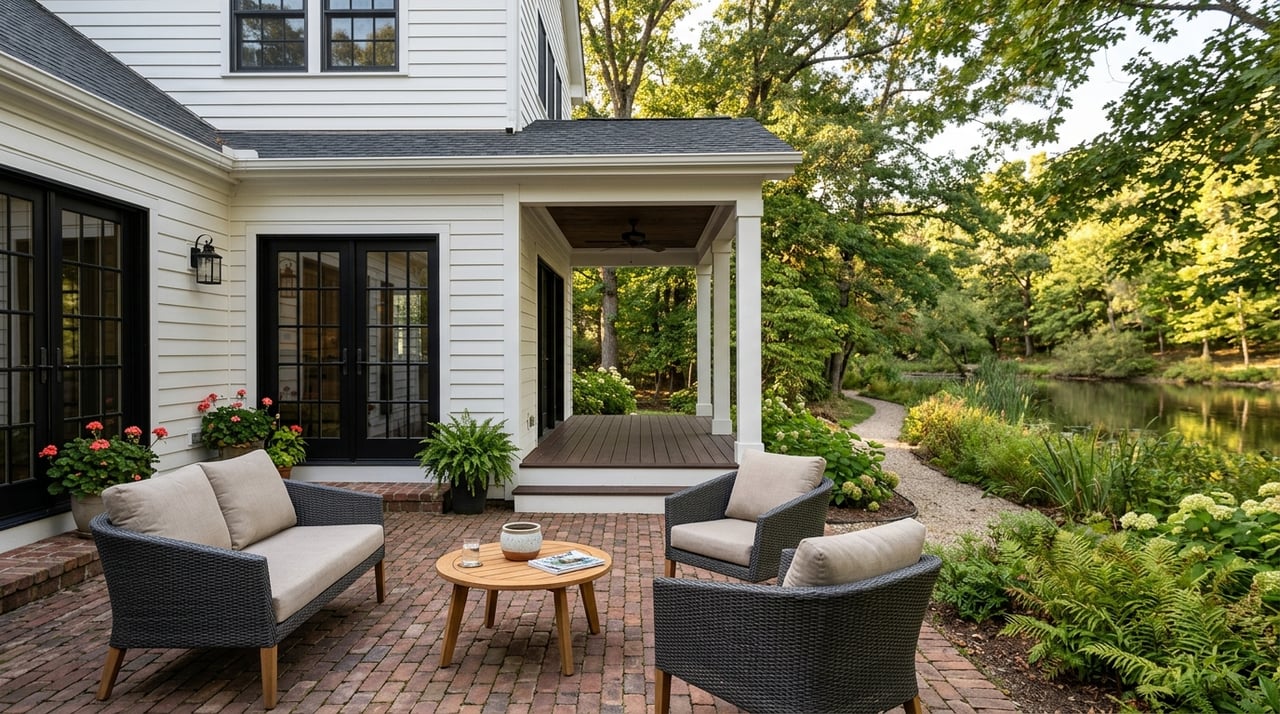
Many properties around Broad Bay and the Lynnhaven River, including areas in and around Great Neck, benefit from deeper channels and service from marinas and yacht clubs. Access can be year‑round depending on the exact lot, proximity to maintained channels, and bridge clearances on your route.

Lago Mar and Ashville Park canals

Interior canal and creek neighborhoods such as parts of Lago Mar and Ashville Park can be more tide‑dependent. Depths vary lot by lot, and many canals rely on HOA or municipal dredging to maintain access. Expect dock size limits and confirm the history of dredging before you commit.

Local infrastructure to check

Rudee Inlet and Lynnhaven Inlet are the primary gateways to the Atlantic for Virginia Beach boaters. Check recent dredging updates, bridge clearances on your route, and marina guidance for practical on‑the‑water insights. City public works and VMRC records help verify permits and maintenance plans.

Shoaling and dredging patterns

Inlet and beach‑adjacent channels tend to shoal and need periodic dredging. A recent project can restore depth for a time, while gaps in maintenance usually lead to gradual loss of depth. Ask for dates, sponsors, and schedules for any dredging that serves your canal or channel.

Buyer and seller checklists

Pre‑offer verification list

  • Nautical chart extract showing your route to open water, with depths and the chart datum.
  • Recent soundings or a hydrographic survey at the dock and along the route.
  • Written bridge clearances and the tidal datum used for those measurements.
  • Records of the last dredging event and any planned maintenance schedule or assessments.
  • VMRC and city permits for existing docks, boathouses, and proposed improvements.
  • Photos or notes that document water depth at low tide and the condition of the dock and bulkhead.

Agent questions to confirm

  • What is the controlling depth from the property to the inlet and which chart is referenced?
  • Are there fixed or opening bridges on the route and what clearances apply at typical tides?
  • Who maintains the channel and when was it last dredged?
  • What rules or permits govern pier length, slip count, and boat size?
  • Who can provide current local conditions, such as the harbormaster or a nearby marina?

When to bring in pros

  • Before you write an offer if your vessel’s draft or air draft may be constrained.
  • During due diligence to hire a licensed marine surveyor or local captain to confirm depths, clearances, and realistic tide windows.
  • Anytime a listing claims “deep water,” ask for recent soundings or maintenance confirmation.

How we help boaters and sellers

You deserve clear, confident guidance on tides, depths, and real access. As Waterfront Experts, we align your vessel’s draft and air draft with the right properties, verify route constraints, and present waterfront homes with the premium marketing they deserve. Whether you are upgrading slips, right‑sizing boats, or listing a canal‑front home, we help you move with certainty.

Ready to make a smart waterfront move in Virginia Beach? Connect with the team at 4 Oceans Real Estate Group LLC for a consult, or get your instant home valuation.

FAQs

What does “tidal access” mean for Virginia Beach homes?

  • Tidal access means your depth depends on the tide cycle, so you may only enter or exit safely around mid to high tide and need to plan trips to avoid grounding at low tide.

How deep is “deep water” for my boat purchase?

  • There is no single standard. Many smaller powerboats work with 6 to 8 feet, while larger yachts often need 10 to 15 feet or more. Match depth to your draft plus a safety margin.

How do fixed bridges impact ocean access from my dock?

  • Fixed bridges limit air draft. Compare your mast or radar height to the posted vertical clearance at the expected tide height, and confirm any opening bridge schedules on your route.

What proof should I request before buying a waterfront property?

  • Ask for recent soundings or a hydro survey, the controlling depth to open water, bridge clearances with datums, dredging history, and VMRC and city permits for docks.

Are canals in Lago Mar or Ashville Park always shallow?

  • Depth varies lot by lot. Many interior canals are more tide‑dependent and rely on periodic dredging, so verify recent maintenance and the controlling depth before you buy.

Is Great Neck more likely to have deep‑water access?

  • Many areas near Broad Bay and the Lynnhaven River have deeper channels and marina support, but access still varies by exact location, route, and bridge clearance.

Who maintains Rudee and Lynnhaven inlets in Virginia Beach?

  • Maintenance is typically coordinated through public agencies and scheduled dredging. Ask for the most recent dredging records and local condition updates before you rely on a route.

Work With Us